1.
a) We should not use the geographic coordinate system because it is designed to represent the surface of the earth in 3-D. The projected coordinate system is designed to represent earth on a 2-D surface like our computer screens. The projected coordinate system can have constant lengths, angles and areas which makes it the ideal choice for making and using maps.
2.
a)
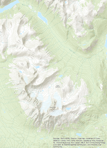
Teepee Mountain Northwest British Columbia
3.
a)
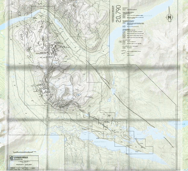
Teepee Mountain with TIFF map overlaid
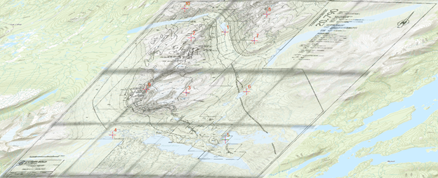
4.
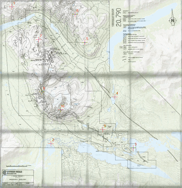
Assigned control points (CP) for Teepee Mountain
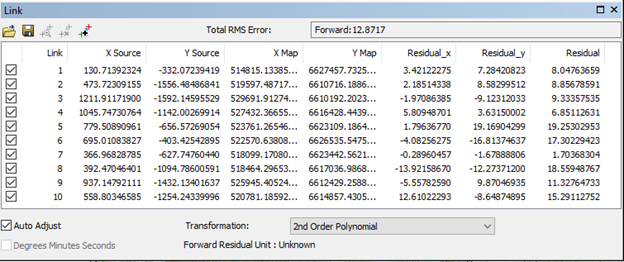
Georeferenced Map of Teepee Mountain using 2nd Order Polynomial
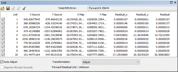
Residual values: they tell us the magnitude of transformation that must be applied to fit the TIFF map on top of the base map. Obtaining the lowest residual values possible will result in a more accurately overlaid map.
Reasoning for CP: the first 6 were placed around the mountain to make sure georeferencing was done evenly. CPs 7-10 were placed closer to the center in areas that the TIFF file and basemap had in common. I used intersecting water water bodies and contour lines for finding my CPs. Areas where rivers discharged into lakes and hilltops of mountains were among the most useful landforms to use as a CP.
5.
I used the 2nd Order Polynomial transformation because it provided just enough bending and curving to georeference the map accurately. The 1st order polynomial had high residual values and the 3rd order polynomial distorted the map too much in areas without control points. I also think having 10 control points was ideal for using this transformation because the minimum is 6.
6.
Georeferenced Map of Teepee Mountain using Adjust Transformation
I used the Robinson (sphere) projection because I wanted to see how much distortion would show in this area of Northern BC. This was a challenge at first because of the longitudinal stretch but after finding common landforms it became easier. After using the adjust transformation the map fit very well and resulted in little residual values.
7.
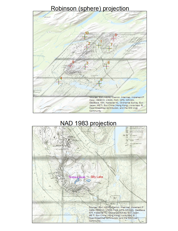
Robinson (sphere) projection: The pro is that this projection looks aesthetically pleasing when looking at the entire world. The con is that it is neither equal-area nor conformal. Distortion near the poles is severe which makes this map hard to use for directions and for measuring distances.
NAD 1983 projection: The pro is that this projection has minimal distortion when looking at narrow regions. The con is that when looking at features in several UTM zones or when looking at the entire world the projection will not be accurate.
The choice of the projection system should match the location and scale of the map that is needed. A poor choice could lead to high residual values along with unnecessary distortions. Each projection has its pros and cons, it is up to the GIS user to decide which one is best suited for its purpose.
