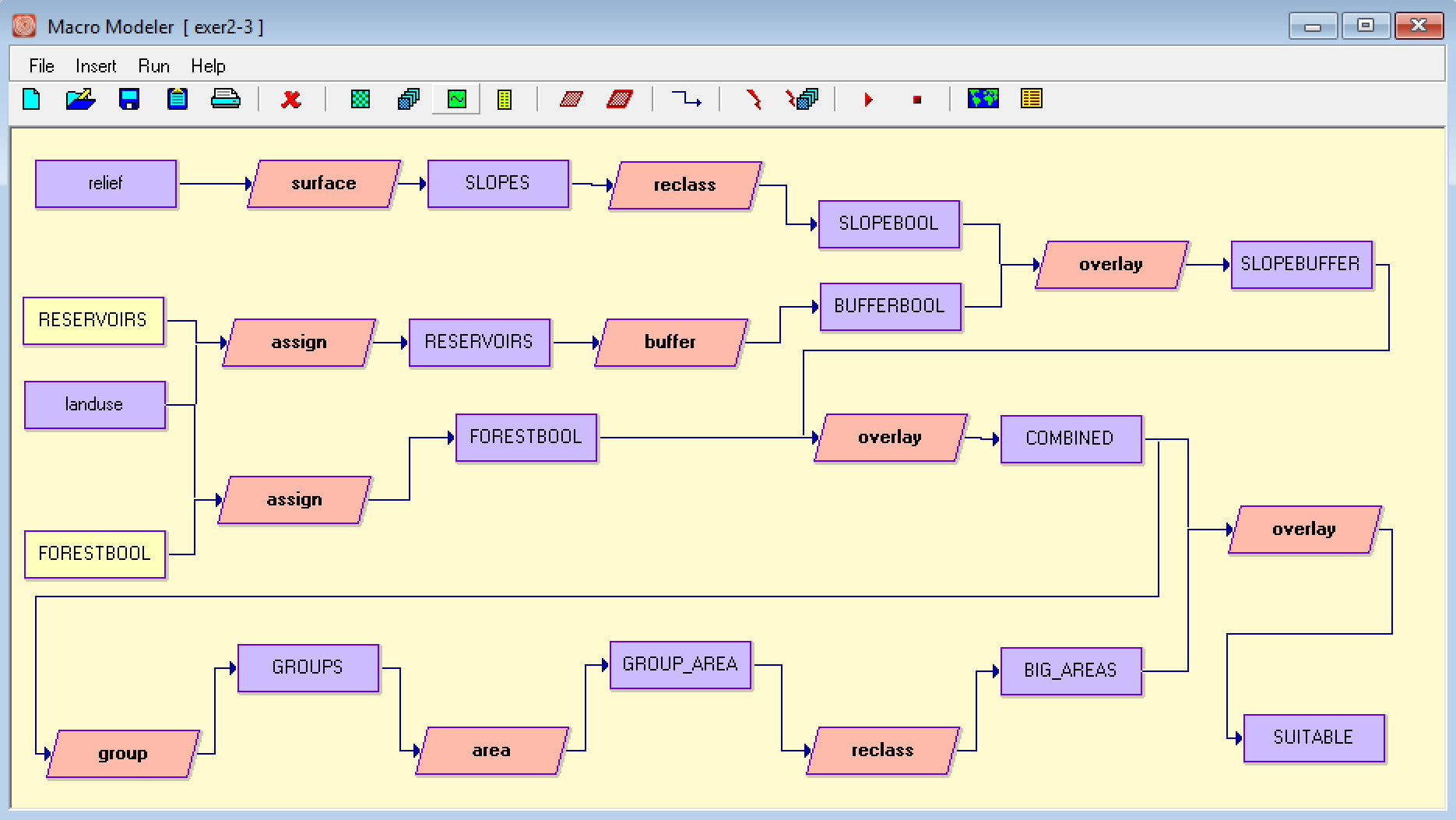
1.
a)
Euclidean distance calculator uses a straight line between 2 points and is based on the Pythagorean equation. An example: calculating the walking distance from a house to the nearest tree without obstacles in the way.
Manhattan distance calculator uses a raster grid and calculates the number of pixels to get from A to B. The value is obtained by counting adjacent pixels as 1 and across pixels as 2. An example: calculating the driving distance from A to B in an urban environment with many buildings.
b)
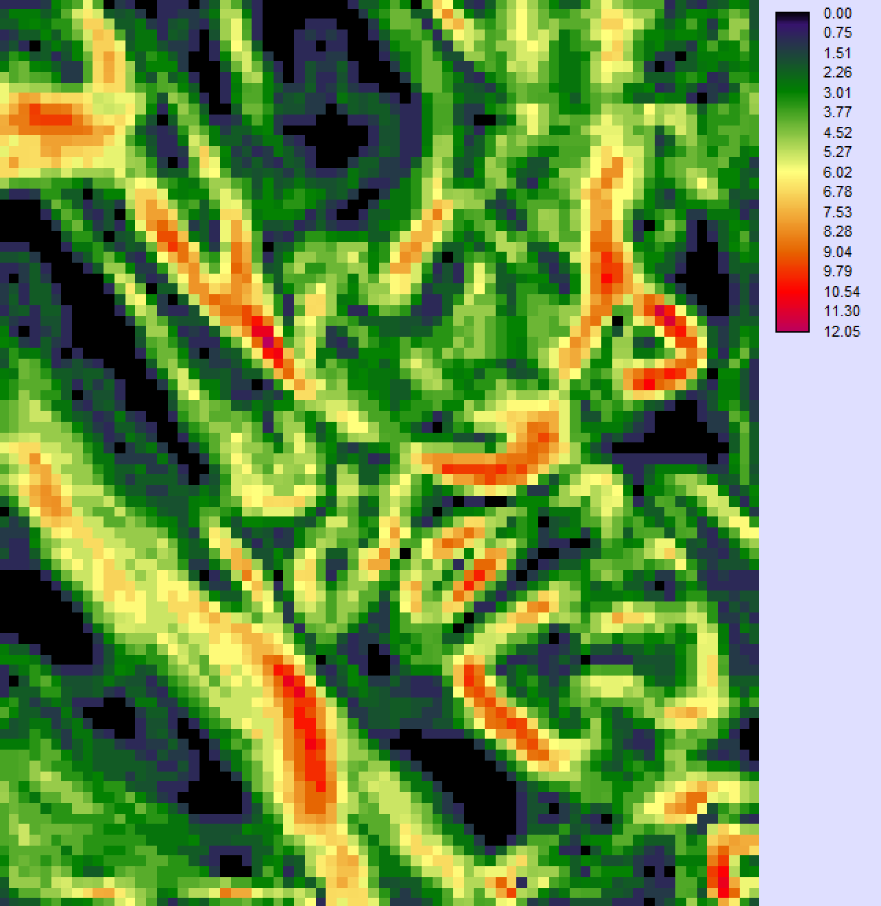
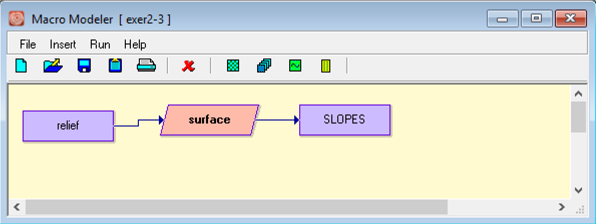
Slope Surface Map of central Massachusetts
c)
Buffer is better here because we need a categorical representation of distance, instead of a continuous one. By using this module, it also requires less steps to obtain our buffer zone image.
d)
Biggest area: 11.07 hectares
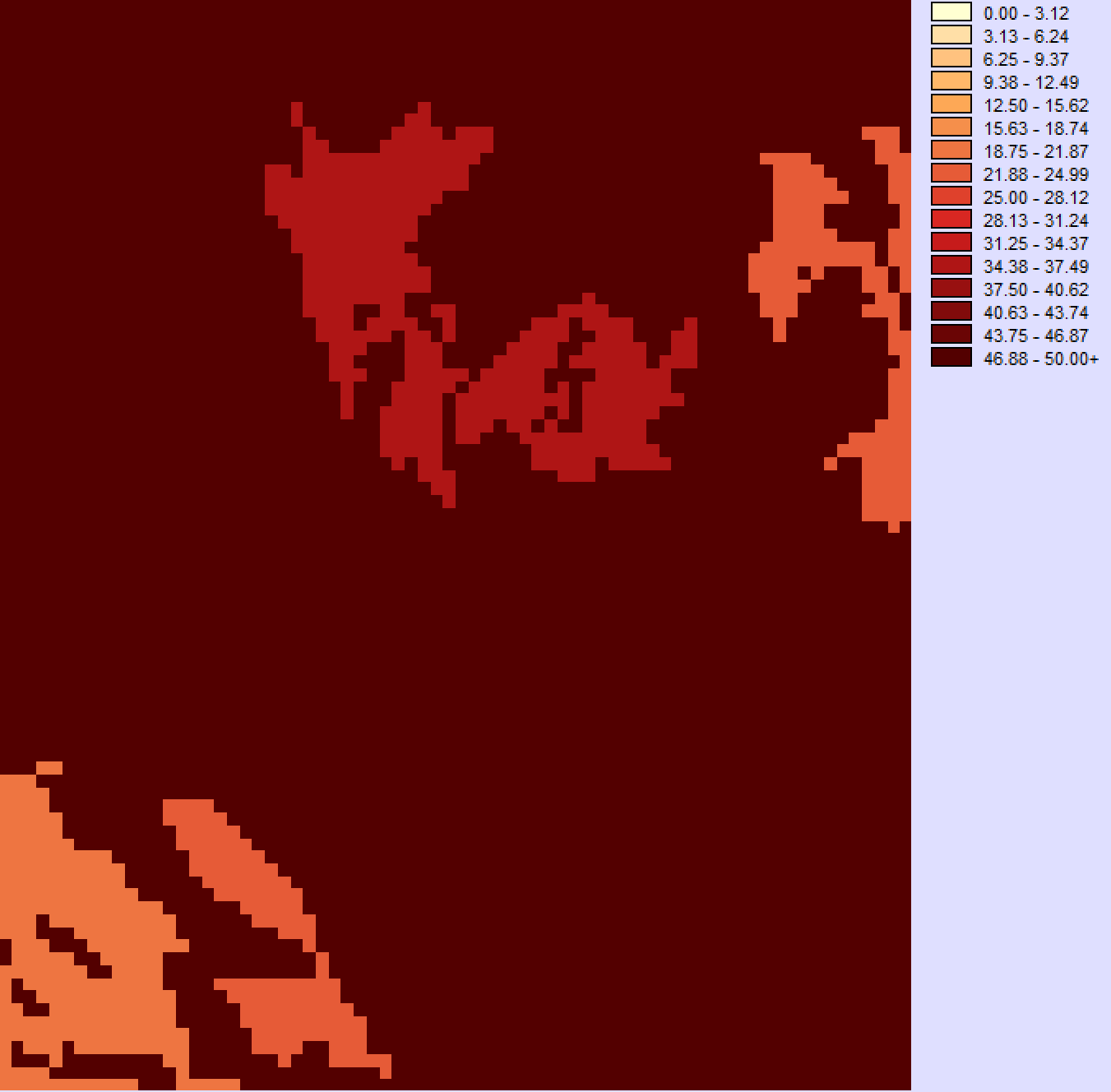
2.
a)
Suitability maps for a light manufacturing plant in Massachusetts
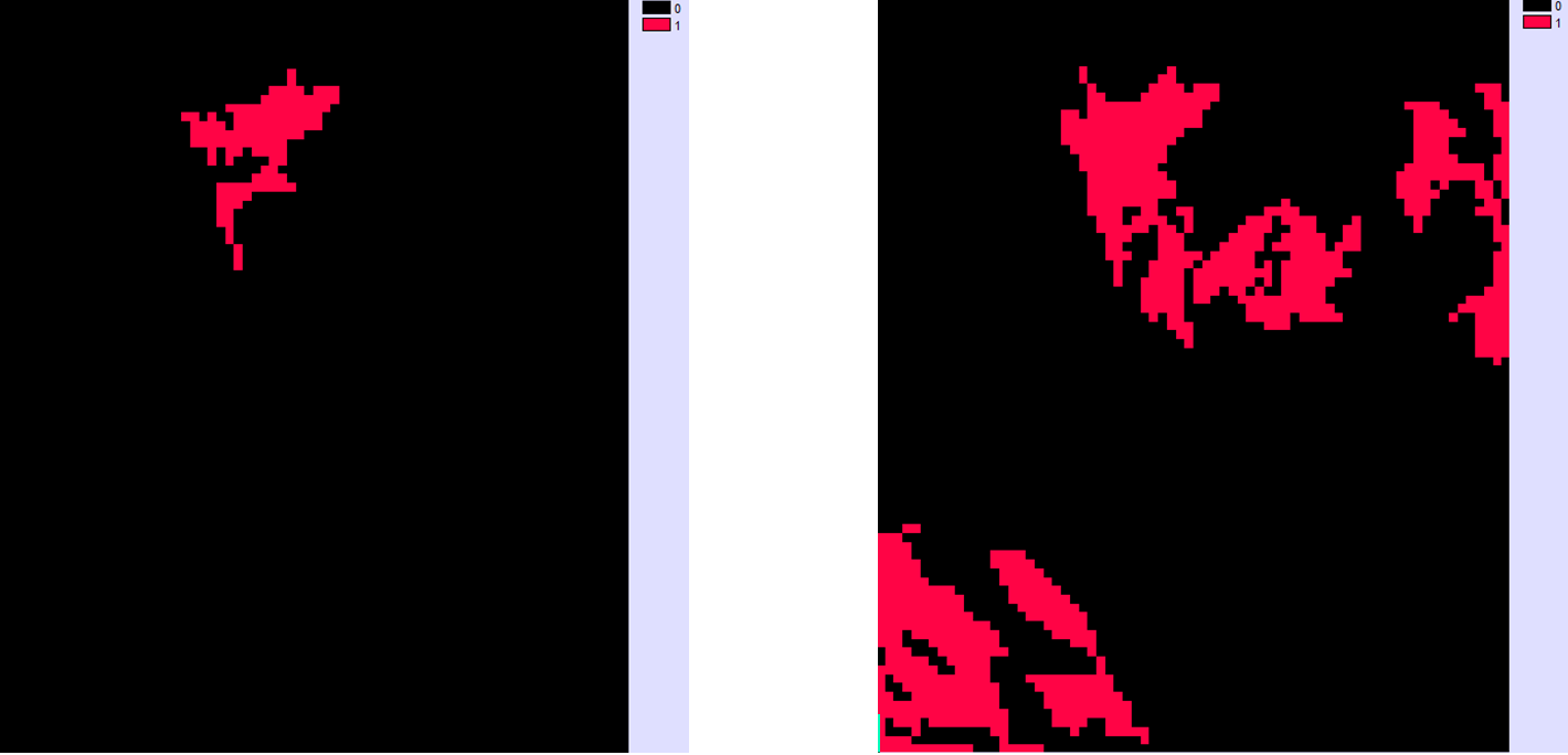
On right: suitable areas on less than 4.5 degree slope
b)
Using the map bellow we see 4 distinct locations that are suitable
c)
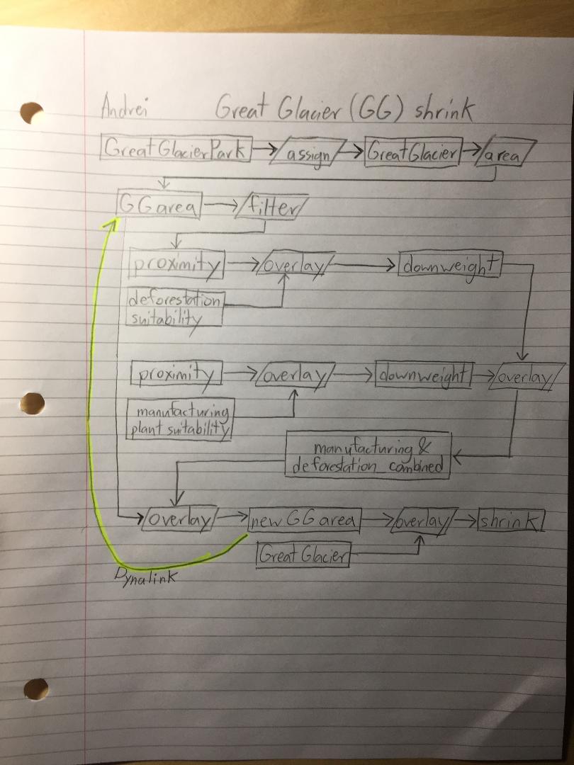
Dynalinks can be used in monitoring glaciers over time by allowing the substitution of inputs to become new outputs . The cartographic model above can be used to show the rate in declining area of the Great Glacier in BC. Deforestation and the release of CO2 from manufacturing plants are the biggest local factors that will shrink the size of the glacier. The closer these things are, the more they will affect the glacier. By using Dynalinks we can monitor to what degree these factors change the size of glaciers over time.
d)
Submodels help in 2 major ways. The first way is that they allow for more complex analytical workflows. If a module that is required for a project is needed but it doesn’t exist in Terrset the user can make their own. The second is that it helps save time when a workflow needs to be repeated in multiple areas or scenarios. For example if a workflow that can calculate the likelihood of landslides was created and saved as a submodel, then this can be inserted as a module in future workflows, without having to put in entire landslides workflow again.
3.
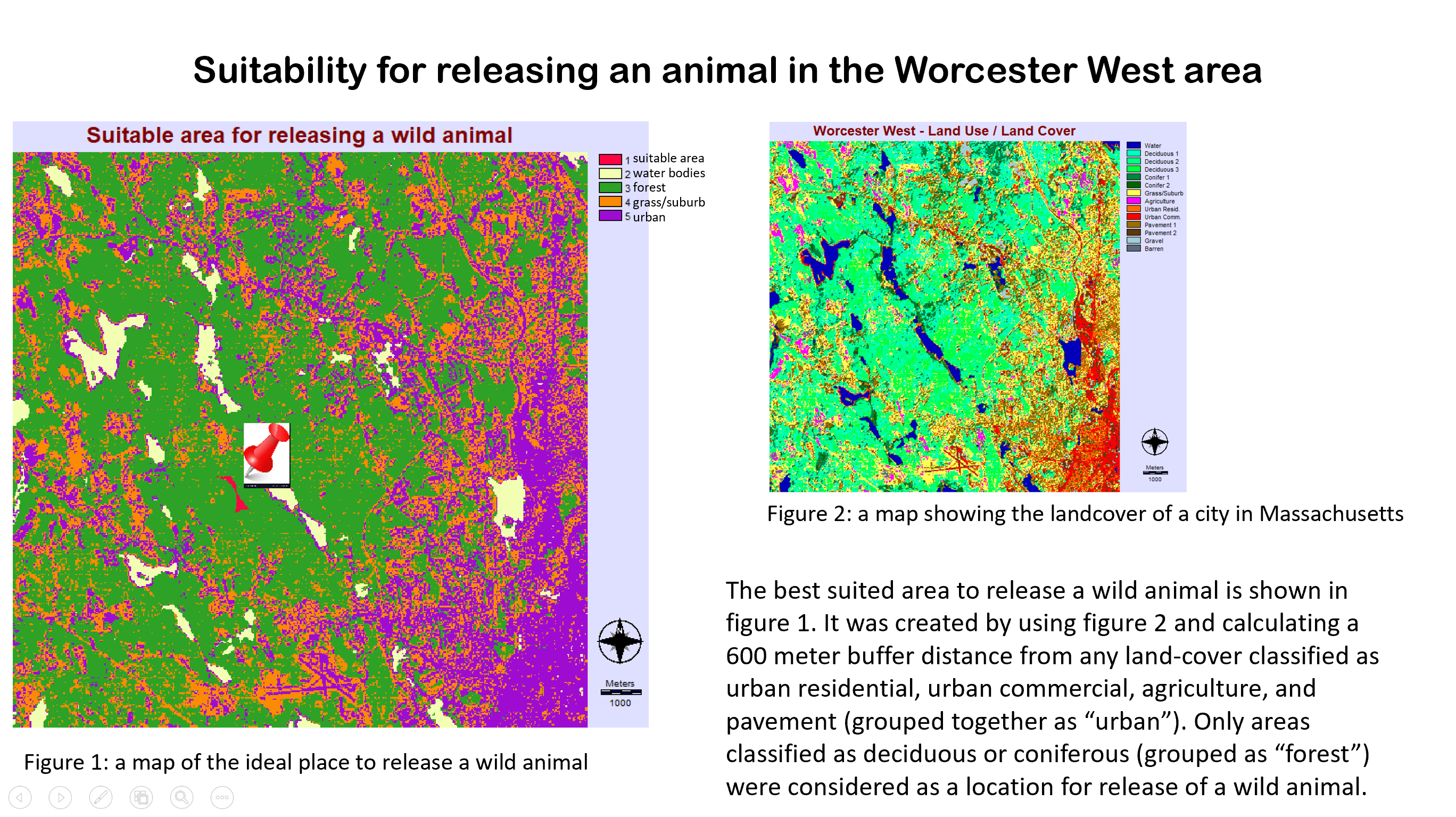
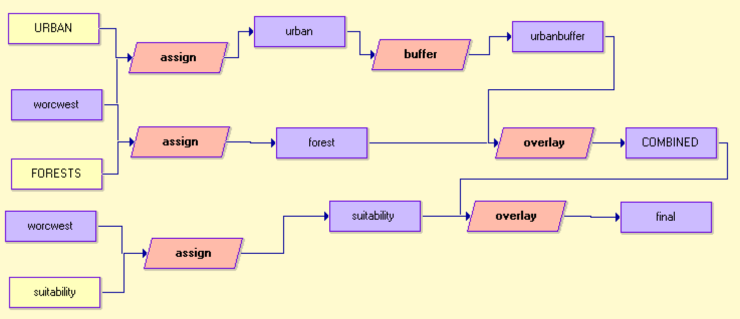
The land-cover scenario that i will be representing helps the population in the Worcester West area decide on the best area to release a wild animal. Based on sources like http://www.wildlifeanimalcontrol.com we can see that once an animal is trapped it should be released as far away from humans as possible. This is to ensure the safety of the animal and to prevent it from entering human food resources. 600 meters was the largest buffer distance from urban land that resulted in a single suitable area.